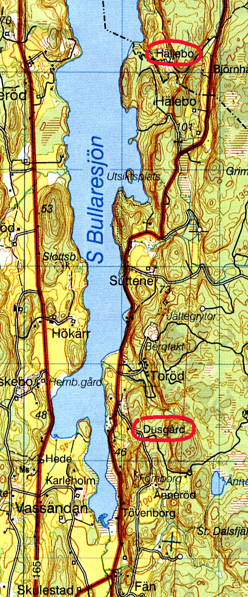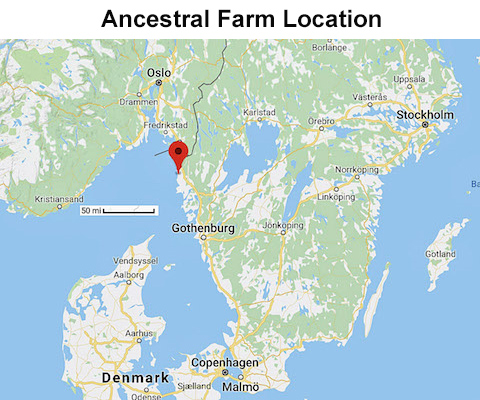
The ancestral farm Helgebo (Häljebo in Swedish) was in Mo Parish on the east side of Lake Bullaren at the foot of Kynne Mountain. Its latitude and longitude is 58º 39' 31.16" North, 11º 34' 34.64" East. The map above shows its location in Sweden and the one of the right shows its location on the shore of Lake Bullaren. It is inland from the coastal town of Fjällbacka and north of the village of Hällevadsholm.
In 2018, Häljebo was owned by a German who used it as a vacation home.
According to tax records, Olof Andersson also owned a farm named Dusgård in 1850 and his father, Anders Andersson, owned it in 1800. Our connection to this farm was found in 2023 by cousin Anna Andreasson, a descendant of Olof Andersson’s son Carl Johan Holmberg, and it was visited by her and Ralph Holmberg, another descendant of Carl Johan. The map at the right also shows Dusgård’s location near Lake Bullaren.
In 2023, Dusgård was owned by a Swedish couple whose daughter used the property as a summer house.
The Häljebo and Dusgård farm locations are marked here on a regional, topographic map published by Lantmäteriets.
In his later days, Fredrick Olofsson moved to another farm, named either Hällekårret or Hällejäret and that is where Brad’s grandmother grew up. You can find more information about Hällekårret at clicking on this link.